Regional Public Transport Infomobility System

Development of an integrated system for the infomobility of TPL FVG buses
The project
The system designed by Infofactory for regional public transportation allows for the management of information flows to the website, onboard and ground monitors, e-link posts, and totems, for all buses in the Friuli Venezia Giulia Region. Furthermore, through the same tool, internal information flows dedicated to emergencies, reports, and communication with drivers through a dedicated app are also managed.
The design phases included the analysis of management processes, the definition of strategic objectives, the study of the requirements necessary for the development of technology, and finally the development of specific interactive prototypes.
The result
The result is a unique system, both desktop and mobile, for managing information.
It integrates with existing management systems, GPS vehicle tracking systems, monitor management and digital billboards, apps for drivers and travel planners.
All information that is published on the different channels can be managed through a single interface.
Analysing & understanding.
Design is also about logic, not just UI.


Some interesting
features.
News management.
Distributed editorial staff and centralised control. Geolocalised and user-filterable news.
Travel Planner.
Integration of MyCicero's Travel Planner for travel planning.
Customised timetable.
User can build customised time tables showing only the stops and trips of interest.
Purchases.
Integration of the subscription purchasing system operated by CapGemimi.
Real Time.
Integration of data from Pluservice's vehicle tracking systems. Finding the position of each vehicle and estimating the exact time of arrival at the stop.
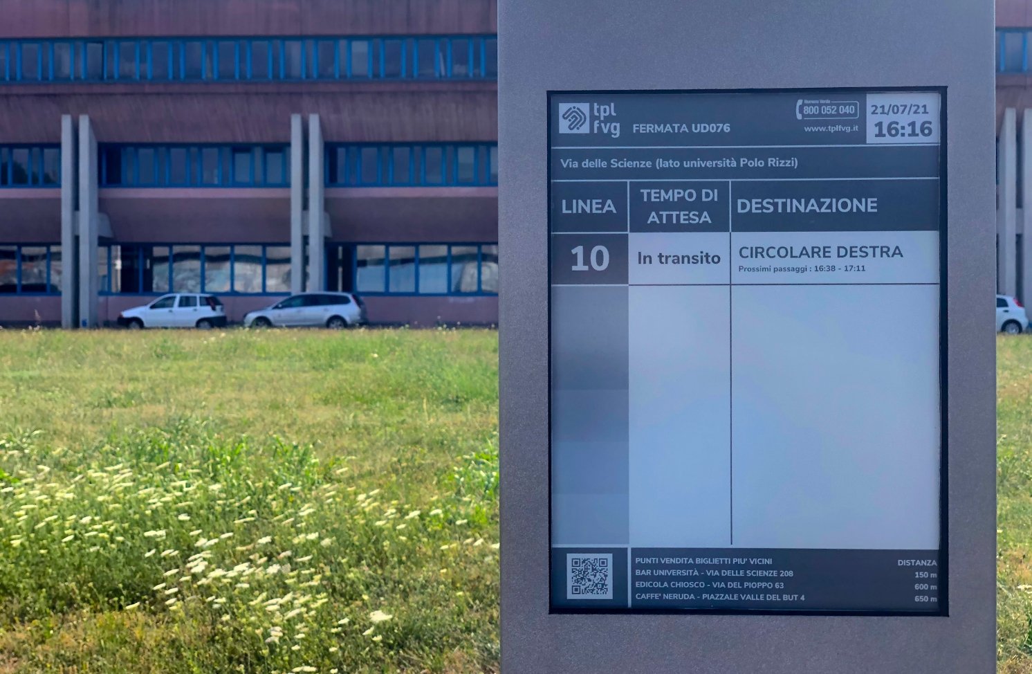
Stops.
Geographical search of all stops in the region with the possibility of viewing the vehicles in real time and all lines passing through the selected stop.
Lines and routes.
Search and visualisation of all lines and routes and web and mobile visualisation of all data in tabular form.
Dedicated area.
Every user can view their own subscriptions, those of the family, personalized schedules and stops, make payments and much more.
Live chat.
Customer support through real-time chat.
Internal pinboard.
Internal service change management system, rapid communication between operators.
System Integration and multi-channel information delivery.

Multiformats + Multichanneling?
The information is the same, but the CMS allows different versions of it to be managed so that it can be sent to poles, totems, on-board monitors, twitter and website!
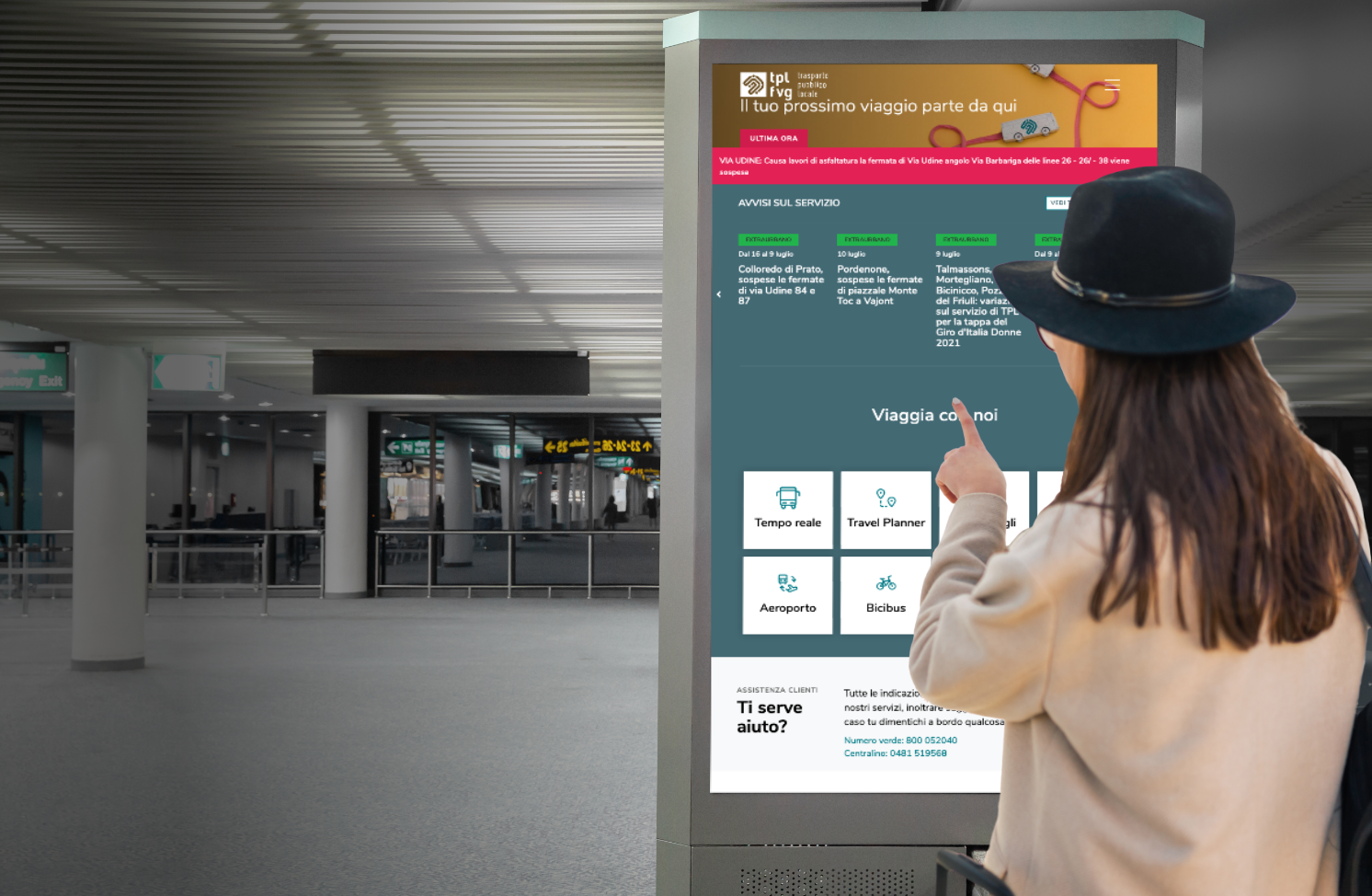
Interactive totems.
The infomobility system presents a new version of the website specially created for the interactive totems provided by GDS. The system interface is adjustable so that it is also accessible to wheelchair users.
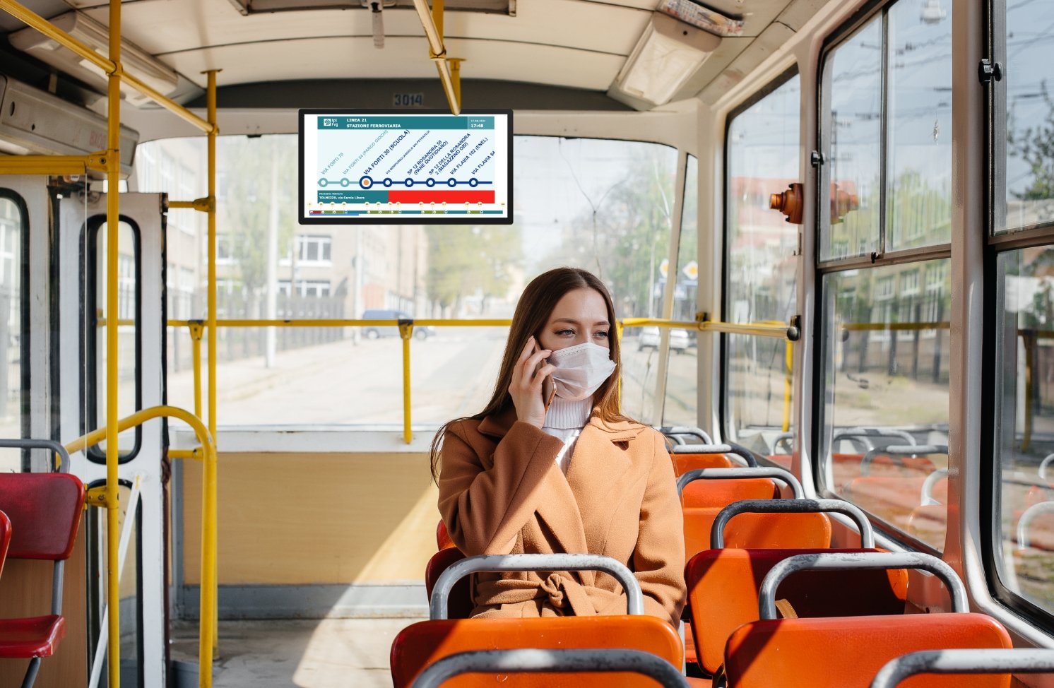
On-board and land-based monitors.
The infomobility system allows the construction of content playlists. The LPT operator can decide the timed sequence of content (images, warnings, videos, advertisements, information) on the route and the next stop and send it to the on-board monitors of the buses.
It is also possible to have a web preview of the playlist before it is sent.
E-ink terminals.
The web interface allows you to select billboards from a map or a list, check what they display, prepare new messages, preview the result and publish it on the chosen billboards.